A quick automagic mix of the week's photos.

The last day...
Today dawned even better than yesterday. Clear and calm. We packed up all the gear and our belongings and shuffled them into cars before we checked out. One team headed back to the calibration site to set it up again while the second team headed to a new site to measure and scan. The hyperspectral calibration set-up went a little more smoothly today and you can see the setup and one round of spectral collection in this video (sped up 100x).


Airborne Research Australia also flew the entire site again, taking advantage of the super clear and calm conditions. The imagery should be superb.

Airborne Research Australia flying over the calibration site


The survey and scanning team spend the (pretty hot) day somewhere a little cooler than the Quarry we were stationed at. This was one of the clearest sites, a little more Garna grass to shred legs but beautiful tall E. Obliqua everywhere. Look around on the Photosphere of the site below.


Today was also the day all the collected data was compiled and backed up. Trips like this are a significant investment in both time and money so it's critical that all the data collected is captured in a way so that nothing is lost, it has comprehensive metadata and becomes free to access and reuse. For most data sets we use Open Data Kit as an end-to-end collection solution. On the drive back to Hobart today our various devices automatically uploaded over 500mb of data as soon as we were back in mobile range to the Auscover ODK Aggregate server so it's safely backed up and ready to access using standard database tools. From here, it will be merged with any instrument data, checked for errors, and then uploaded to the Auscover portal for anyone to access. Cool.
Data collected today is uploaded to the Aggregate server as soon as a network connection is available


So that was a wrap - the week went really well and we achieved all we set out to collect, and more. Thanks to all the team and the Forestry Tasmania folk who came down to help, discuss, lug gear, cook, wash up, climb over decaying logs, work ridiculous hours and above all have a great time, share and learn from each other.
A quick scan of the team using the Riegl #TLS #lidar at the Warra Flux Tower.


A clear day!
It's going to be a good day for the flight so we head out to a quarry near the site to set up the ground calibration targets.

These are large fabric tarps with nice uniform reflectance which can be used to calibrate or check the calibration of the airborne hyperspectral imagery. Once laid out (which was a little tricky due to the wind - these things are like sails) we get started measuring their reflectance with the ASD calibrated to reflectance with the lab panel.

This is a snapshot of the spectra we're collecting. The black target has a very low reflectance,  the white is pretty bright across all the bands and the grey looks grey in the visible but bright in the infrared. The really noisy bits are the water absobtion bands where hardly any light in these wavelengths from the sun reaches the ground where we are measuring.

Understanding the atmospheric conditions are critical for correcting the imagery. We take measurements using two microtops sun photometers throughout the airborne campaign to get estimates of aerosol optical depth, water vapor and ozone.

The registration of the imagery is also critical. Using DGPS referenced to a known survey mark the locations of the field targets are precisely surveyed.

Mind you, once everything is set up there is some spare time. Here, some scientists take a walk up to a ridge to look at the view below...

Unfortunately, there were some issues with the plane collecting the imagery so it had to abort after a couple of hours.  So we'll be back again tomorrow to do it all again. To fill in the afternoon we went laser scanning over one of the long term fire and log decay sites. It was one of the most difficult sites I've had to survey due to the density of vegetation and fallen logs.

We finally finished about 7:30pm and after downloading data and charging equipment we had a small birthday celebration BBQ for Iain (with a custom made marsmallow chocolate biscuit sandwich). Last day tomorrow.  Another flight and another full site survey.  Its going to be big...


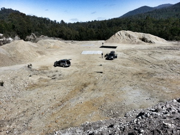
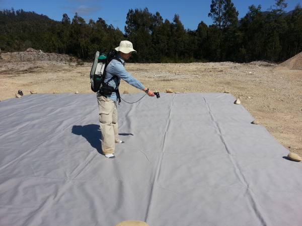
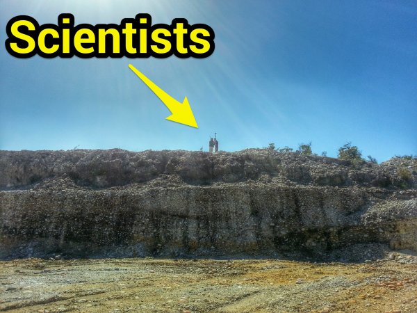
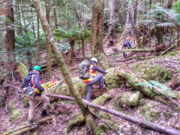
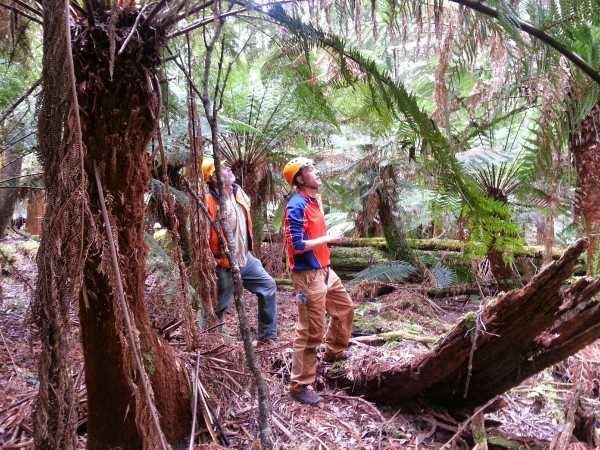
Day three and the teams went to several sites. We headed off to a pretty remote site requiring a one kilometre walk in over fairly rugged terrain carrying all the gear.


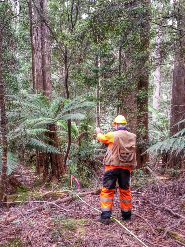
Once on site we rolled out the tapes. We go in a straight line out 50m on 6 radials from the centre point.

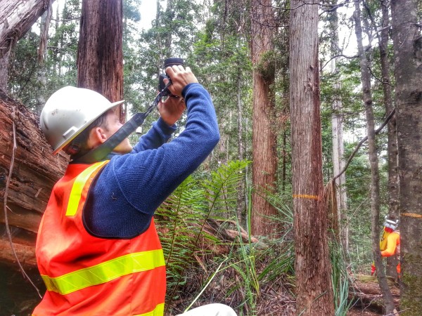
A lot of the work we do is designed to link traditional forest measurements with the lidar sensors. Here we are collecting tree basal area using a wedge.

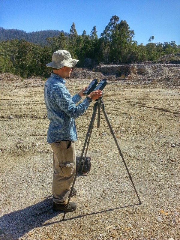
One of the traditional first light climate measurement is hemispherical photography. We've been lucky enough here to have cloudy skys which give diffuse conditions during the day, negating the need to be out at dawn or dusk.

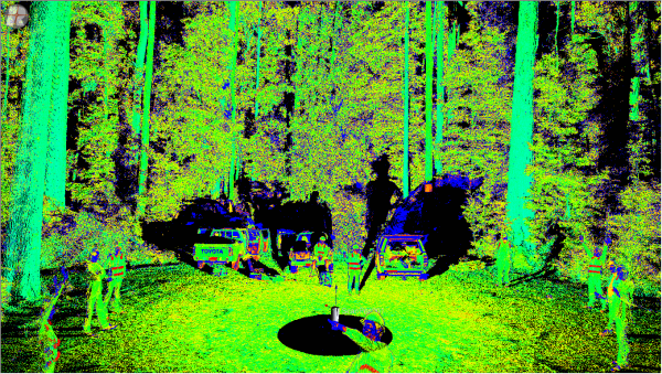
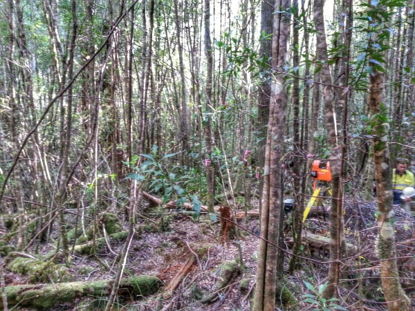
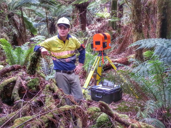
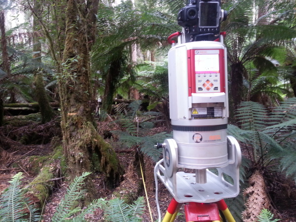
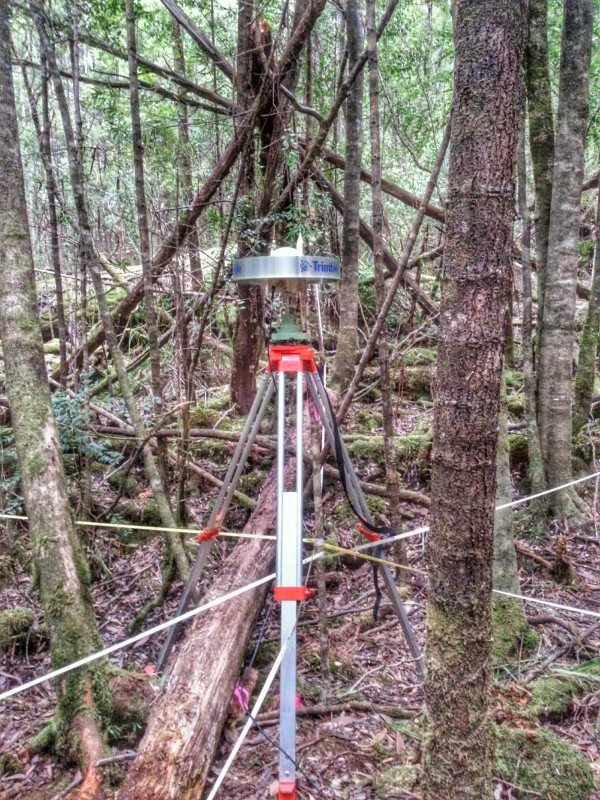
This site had a fair bit of slope and debris so on places we had to use rather 'interesting' scan locations.

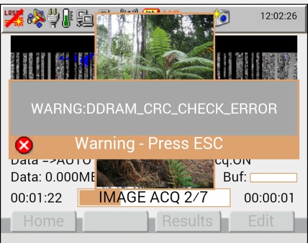
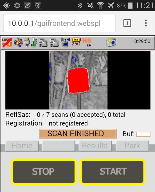
Because of this (or more likely due to the density of the vegetation ;) we had more than our fair share of scan errors today. Capturing data at the rates we get in these forests pushes the software and ends up finding the bugs.

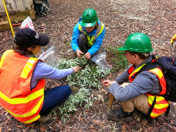
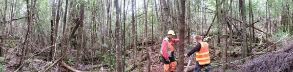
After successfully completing the site and walking out we headed back to the Flux tower to catch  up with the leaf sampling team who had been collecting samples from all the key species across the site.

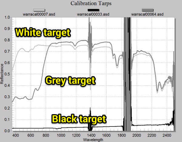
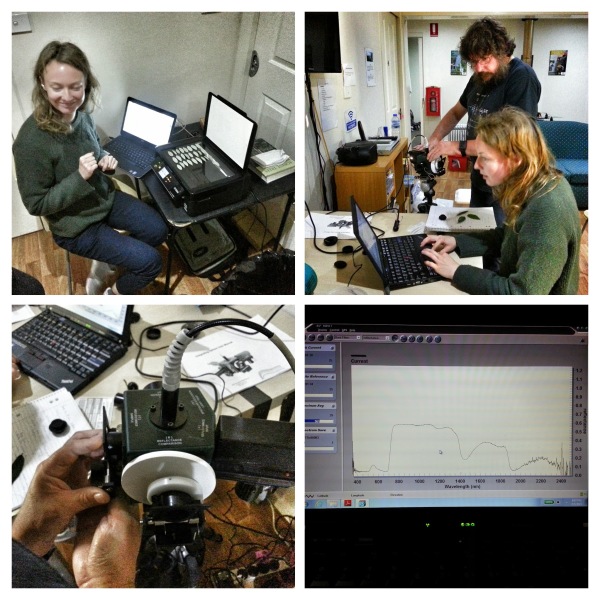
They extract pigment samples ASAP and freeze them in liquid nitrogen. The remaining leaves head back to the camp  for spectra to be taken through the evening by the ASD spectometer with an integrating sphere attachment.

DWEL, the TERN/CSIRO dual wavelength lidar was also busy today at the Flux tower sampling across the transects to match up with the field data collected by the team yesterday.  Keep an eye on the DWEL blog!

Tomorrow we're hoping to have awesome clear sunny conditions for the airborne hyperspectal data collecrion. Fingers crossed...
After a hearty breakfast (thanks to Iain) we got started back at the flux site. Due to the density we're doing seven TLS scans per site in a star pattern to match the transects. 

We've also deployed 18 reflectors across the site to help with registration of the scans. These are very bright targets that have a known size and are visible to the scanner from far away. The display mirrored on my phone of one of the targets looks like this:

Today we also saw the tree climbers  arrive on site.  They'll be rigging ropes and preparing to collect canopy leaf samples from selected trees which we'll scan, weigh, collect reflectance and transmittance and measure chemistry. I'll get some details on this later in the week.

All the sites are geolocated using RTK and post processed DGPS. Here's the Trimble set up to log overnight. We'll get cm accuracy even with the dense canopy.

Finally we moved onto the log decay site and laid out the tapes in preparation for sampling tomorrow. This site is pretty interesting in that it contains a mix of old growth and more recent regrowth and a huge number of fallen trees. It's going to take a while tomorrow...

As night fell, instruments were downloaded and charged, weather was discusssed (looks like the hyperspectral flight will be on Thursday), planning for day three was discussed and the leaf sampling  team got to work.